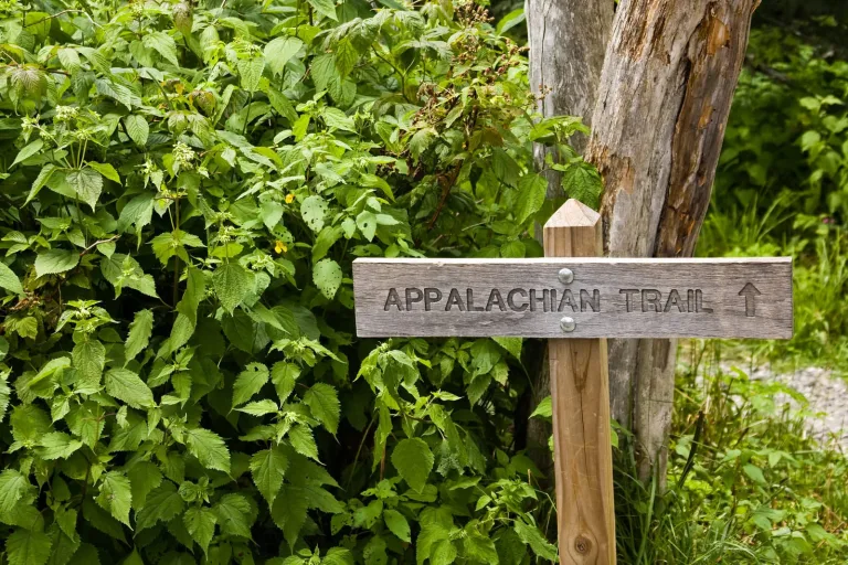
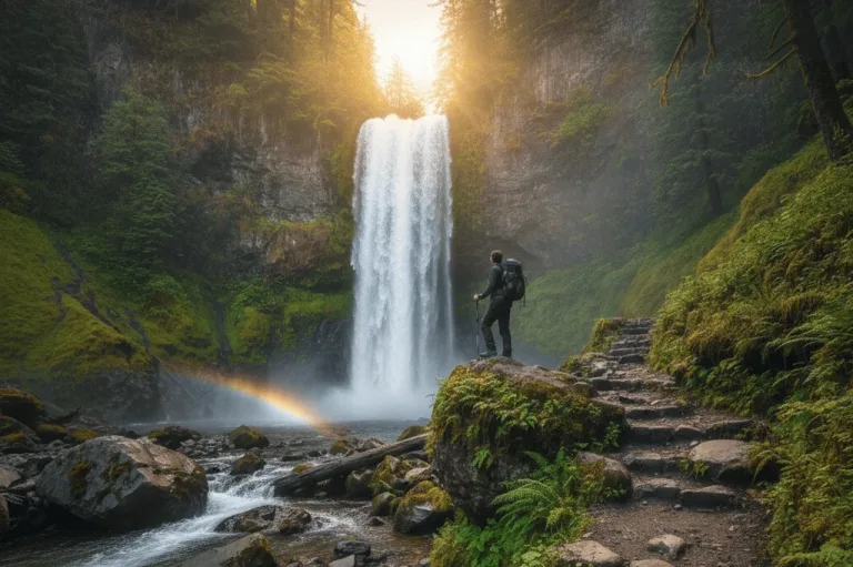
The Pacific Northwest pulls in millions of hikers every year with its volcanic peaks, misty rainforests, and dramatic coastlines. But here's the thing: while everyone's jamming into the same overcrowded parking lots at Rattlesnake Ledge or waiting in line to photograph Multnomah Falls, there's a whole other world of trails out there.
These hidden gems offer something the famous spots can't deliver: actual solitude, pristine conditions, and that rare thrill of feeling like you've discovered something special. The National Park Service reported a record 331.9 million recreation visits in 2024, with most visitors clustering at the same well-known destinations.
What Makes the Pacific Northwest a Hiker's Paradise
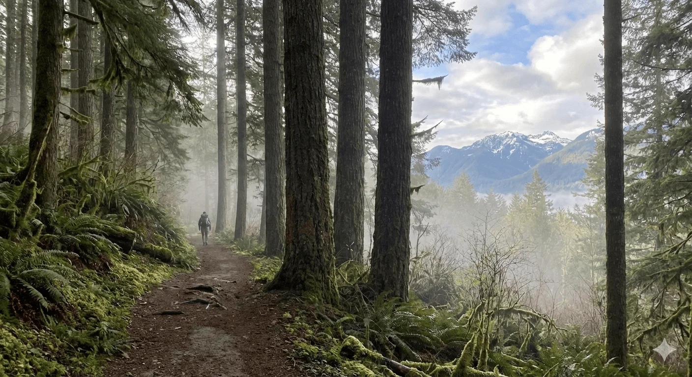
Pacific Northwest hiking trails pack incredible variety into a relatively small area, letting you hop between completely different worlds in a single weekend.
PNW Explorer's Pick
Best for tackling the wet, wild Pacific Northwest
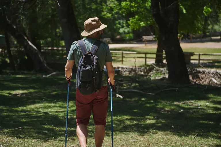
PNW trails mean moss, mud, and unpredictable rain year-round. A waterproof pack cover, grippy trail shoes, and a reliable rain shell are non-negotiables. REI — born in Seattle — is the most-used outfitter for Pacific Northwest hikers.
- Coastal rainforests to high desert: Head west and you're walking under Sitka spruce in forests where everything's covered in moss. Drive two hours east, and you're suddenly in juniper-dotted high desert with big skies. In between? Alpine lakes reflecting volcanic peaks, old-growth forests, and coastal bluffs where waves smash into sea stacks. Western slopes can get over 140 inches of rain yearly, while areas across the mountains stay under 20 inches.
- Low-key trail management: Millions of acres stay protected but accessible through national forests, wilderness areas, and parks. Many trails get zero promotion, which is actually on purpose. Not every trail needs Instagram-worthy signs and packed parking lots. This approach keeps crowds down and trails in better shape.
- What separates famous from hidden: Popular Pacific Northwest hiking trails fill every guidebook and usually need parking permits. Hidden gems? They might not show up on standard maps, lack signage entirely, or require navigating unmarked forks with just a topo map. That filters out most casual hikers, leaving these trails wonderfully empty.
Discover Hidden Gems: Pacific Northwest Hiking Trails Off the Radar
These trails won't show up in your average hiking app, and that's exactly why they're worth seeking out.
Hidden Gem Trail #1: Mossy Grove Loop — Washington
Location & Access: Near Forks in western Washington, the trailhead sits about 8 miles south on Forest Road 2932. Parking fits maybe six cars in a small pullout. Fair warning: the final two miles get muddy, so bring a vehicle with decent clearance during wet months.
Trail Stats: This 4.2-mile loop gains just 600 feet, making it pretty mellow for most hikers. Budget 2.5 to 3 hours, or double that if you're stopping to photograph everything.
What You'll See: Massive old-growth Sitka spruce and western red cedar create a canopy so thick that fog gets trapped underneath on typical mornings. The trail crosses three small creeks on moss-covered log bridges that look like they belong in Middle-earth. Around mile 1.7, a 30-foot waterfall suddenly appears, tumbling into a grotto filled with ferns.
Best Times to Visit: Late April through May brings trillium and oxalis blooms covering the forest floor in white and pink. Summer offers cool shade when other trails are baking. October turns the vine maples golden against all that green.
Insider Tips: The waterfall grotto gets the best light between 10 AM and noon. There's a quarter-mile spur at mile 2.3 that branches left to this incredible nurse log supporting an entire row of hemlock trees. The moss-covered boulder outcrop at mile 3.1 makes a perfect lunch spot with views across a small valley.
Hidden Gem Trail #2: Phantom Ridge Traverse — Oregon Cascades
Location & Access: The trailhead sits at the end of Forest Road 4220, roughly 35 miles southeast of Bend. That final 12-mile stretch follows a gravel road that can wash out during spring runoff. Definitely check with the ranger station before heading out.
Trail Stats: This point-to-point traverse covers 9.8 miles with 2,400 feet of climbing. Strong hikers knock it out in 5 to 7 hours. You'll want a car shuttle or pickup arranged unless you're up for a nearly 20-mile round trip.
Scenic Highlights: The entire route follows an alpine ridgeline with views of Mount Bachelor, Three Sisters, and Broken Top. From July through early August, wildflower bowls explode with lupine, paintbrush, and phlox. Most of the ridge sits above treeline, giving you 360-degree volcanic views.
Seasonal Notes: Snow typically blocks access until late June, sometimes early July in heavy snow years. Wildflowers peak about 3 to 4 weeks after the melt. Fall brings stable weather and even fewer people, though nights get cold by late September.
Unique Features: Mule deer, golden eagles, and occasional black bears show up along this ridge, especially in the huckleberry patches. The combination of massive views and almost zero foot traffic makes this one of the best spots for solitude when hiking in the Pacific Northwest. Several flat areas along the ridge work for wilderness camping if you've got an overnight permit.
Hidden Gem Trail #3: Sapphire Lake Path — British Columbia
Location & Access: Near Pemberton, BC, this one requires either a high-clearance 4WD or a shuttle service from local outfitters. The access road is pretty rough, adding 45 minutes to your approach time.
Trail Stats: The 7.4-mile out-and-back climbs 1,800 feet through subalpine forest to reach the lake. Plan on 4 to 5 hours round-trip at a reasonable pace.
Scenic Highlights: Sapphire Lake actually looks like a sapphire, with turquoise water so clear you can see 20 feet down. Subalpine fir and mountain hemlock circle the shoreline, creating perfect reflections on calm mornings. Steep cliffs on the far shore hold snow into August, and that glacial meltwater gives the lake its wild color.
Best Seasons: July and August bring the warmest weather and wildflower shows, with heather, valerian, and columbine everywhere. Late September offers fall colors and incredible clarity for reflection shots, but temperatures really drop.
Camping & Overnight Options: You'll need wilderness camping permits through BC Parks. Two established sites sit on the east shore, though plenty of backpackers prefer unofficial spots along the northern inlet creek. Water sources are plentiful, but filter everything.
Hidden Gem Trail #4: Coastal Driftwood Way — Oregon Coast
Location & Access: This coastal route starts at a small parking area near Cape Meares, south of Tillamook. Everything depends on tide schedules, so check the tables before you go. Park near the headland and take the steep but maintained path down to the beach.
Trail Stats: The 5.2-mile beach walk is easy to moderate, though loose sand and driftwood slow you down. Give yourself 3 to 4 hours to really explore.
Scenic Highlights: Sea stacks rise offshore with their bases carved into arches and caves by waves. Hidden coves between headlands reveal tidepools packed with purple sea stars, anemones, and hermit crabs. Massive driftwood logs, bleached silver from sun and salt, create natural sculptures along the high-tide line.
Safety Tips: Tide awareness isn't optional when hiking the Pacific Northwest trail sections on the coast. Several spots here become impassable at high tide, which could trap you. Carry a tide table, build in buffer time, and wear shoes with a good grip on wet rocks.
Best Times: Low tide windows give you maximum exploration time, usually 4 to 5 hours twice daily. Sunset photography works great from March through October, and those dramatic cloud formations that the Oregon coast is known for show up constantly.
Hidden Gem Trail #5: Hidden Falls Gorge — Washington Cascades
Location & Access: This trail's location stays somewhat secret among local hiking communities. You won't find it marked clearly. The nearest landmark is near Skykomish, with trailhead access via an unmarked forest road that requires careful navigation.
Trail Stats: The 6.1-mile round trip is legitimately strenuous with 2,200 feet of climbing over rough, rocky ground. Even experienced hikers need 4 to 6 hours.
Natural Features: The trail follows a roaring gorge before opening into a natural amphitheater where a 180-foot waterfall drops over basalt cliffs. Those basalt formations create geometric columns that look almost man-made. Multiple viewpoints give different perspectives of the falls and gorge.
Best Views: Morning mist makes everything look ethereal between 7 and 9 AM. Late summer brings lower water flow but clearer views of the basalt. Spring runoff creates thunderous conditions but also potentially sketchy creek crossings.
Pro Tips: Waterproof gear isn't optional since spray from the falls will soak you. Two creek crossings require careful rock-hopping; trekking poles help a lot. The final viewpoint sits on an exposed ledge, so watch your footing and keep kids close.
Hidden Gem Trail #6: Cathedral Ridge Path — Oregon High Desert
Location & Access: East of the Cascades near Prineville, the trailhead is at the end of a dusty road through ranchland. Respect private property boundaries and stick to marked routes.
Trail Stats: The 8.3-mile loop includes 1,400 feet of climbing over moderate ground. Most people finish in 4 to 5 hours, though the desert setting makes you want to slow down and soak it in.
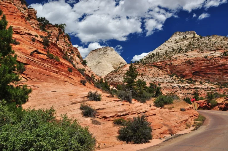
Highlights: Western juniper forests transition into volcanic spire formations that rise like natural cathedrals. Views extend across high desert plateaus to distant mountain ranges. The dry, rocky terrain creates a completely different vibe from typical Pacific Northwest hiking trails, which is refreshing.
Seasonal Cues: Spring (April and May) brings wildflowers like bitterroot and balsamroot while temperatures stay comfortable. Autumn (September and October) gives you stable weather and gorgeous lighting without summer heat. Skip midsummer when exposed sections top 90 degrees.
Photo Ops: Golden hour lights up the volcanic spires and canyon walls in ways midday sun can't touch. Sunset shoots work especially well from the high point at mile 5.2.
Hidden Gem Trail #7: Twin Lakes Sanctuary — Washington's Olympic Peninsula
Location & Access: Tucked into the Olympic Peninsula's interior, this trail branches from a more popular route via an unsigned junction. Creek crossings and some off-trail navigation keep visitor numbers low.
Trail Stats: Different routes reach the lakes, ranging from 11 to 14 miles round trip. Elevation gain runs between 2,000 and 2,800 feet, depending on your approach. Plan for a full day or overnight.
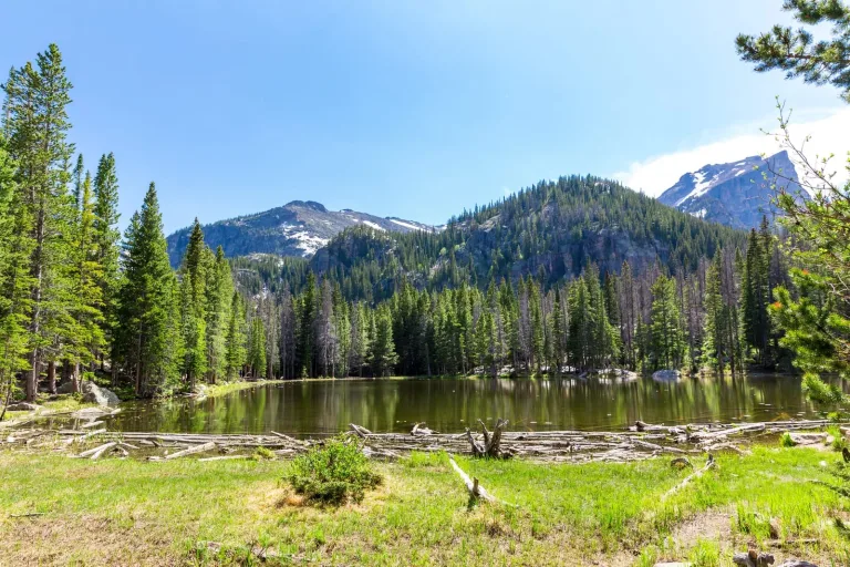
Features: Two pristine alpine lakes sit in a hanging valley ringed by old-growth cedar and hemlock. The upper lake is almost perfectly circular, creating ridiculous reflections on calm days. Small creeks connect the lakes, with sections shallow enough for barefoot wading when it's warm.
Camping Options: Wilderness camping permits come through Olympic National Park. Established sites exist at both lakes, though proper lakeside etiquette means staying at least 200 feet from the water. Bear canisters or proper food hanging are required.
Best Conditions: Access usually opens by mid-July once the snow melts. August and September offer the most reliable weather, though prepared backpackers can enjoy solitude well into October.
Hidden Gem Trail #8: Sunrise Bluff Ridge — Southern Oregon
Location & Access: Near the town of Prospect, this rural trail requires navigating logging roads. GPS coordinates work better than written directions. The local forest service office has current road updates.
Trail Stats: The 5.7-mile out-and-back climbs 1,600 feet to the ridge summit. Call it moderate to hard, needing 3 to 5 hours total.
Highlights: The summit delivers sunrise views across southern Oregon's forests and volcanic peaks, with Mount Shasta visible on clear days. Rare columnar basalt formations create natural viewing platforms. The ridge stays relatively unknown despite killer views.
Seasonal Best: Late summer (August through September) and early autumn (October) bring the most consistent weather. Summer mornings offer the clearest views before afternoon haze rolls in.
Insider Notes: Even weekend crowds stay minimal, but weekdays guarantee more solitude. Show up 30 minutes before sunrise for the best light. The trail gets no official maintenance, so expect downed logs and overgrown spots.
Keeping These Trails Special
These hidden gems show what makes Pacific Northwest hiking trails genuinely special when you get away from the crowds. But as more people find these spots, keeping them pristine depends on all of us.
Pack out everything you bring in, stick to established trails where they exist, and camp only in designated or previously used sites. Maybe think twice before posting exact GPS coordinates online. Sometimes, a general description keeps the magic alive better than precise directions that could overwhelm a fragile area. These trails stay special only if we treat them right.